
We have just released the TANGO1 expedition report. The report will give you an overview of the activities of the TANGO1 team in the West Antarctic Peninsula, onboard RV Australis.
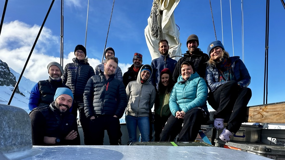
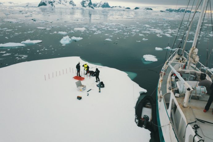
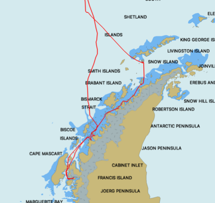
The TANGO1 expedition ventured to accumulate new data on the responses of marine ecosystems to shifts in ice regimes in the West Antarctic Peninsula (WAP), taking full advantage of a nimble sampling platform, the R/V Australis, a steel hulled, fully rigged motor sailor. TANGO1 took place between February and March 2023, sampling two main locations at different spatial scales. Deploying 14 different types of gear (both traditional and modern), the TANGO1 team gathered over 4000 samples that will be brought back to Belgium for further analysis. The team focused on synchronized, transdiciplinary sampling to understand the linkages between realms (atmosphere, sea-ice, watercolumn, seafloor) and there potential responses to changes in climate-changed linked ice regime at various spatial scales.
The use of R/V Australis for coastal studies deemed to be extremely efficient, in terms of environmental impact (ca. 40 times less CO2 emissions than a Polar class icebreaker) and reactivity, allowing the team to adapt the sampling efforts in function of the weather or anchoring conditions. Fully devoted to the expedition, the ship allowed the B121 team to sample in shallow areas, not accessible to icebreaker and too far away from research stations, and which have been under sampled.
The preliminary (meta)results accumulated during TANGO1 confirm the efficiency of using a nimble research platform to study fine-scale processes in the shallow areas of unchartered regions of the West Antarctic Peninsula. TANGO1 provides a first-hand experience to carry an ambitious TANGO2 expedition. Based upon Open Science approaches, the combination of B121/TANGO1 efficiency in sampling paves the way to testing the transposability of the concept to multiply similar efforts in a coordinated fashion.
An overview of initial results is provided below:
Fine-scale bathymetry
An estimated 30 hours were spent to generate sufficient data to generate bathymetric maps All visited sampling sites were charted. The bathymetric exercise allowed reaching a very high sampling efficiency (for example for selecting preferential areas to deploy the SCUBA divers). As a side benefit, the generation charts allowed to identify and flag dangers to navigation which were immediately communicated to relevant hydrographic authorities.
Aerial mapping
A total of 16 drone flights were carried out during the TANGO1 expedition, generating large quantities of media fit for different purposes. Deployment of drones was found to be useful in terms of scouting when arriving in new work station, documenting their general setup as well as carrying out more sophisticated works including orthomosaic (2D) and photogrammetry (3D). Combined to other georeferenced layer gathered during the TANGO1 expedition (ROV imagery, bathymetry, etc…) the aerial imagery has a promising potential in terms of geospatial analysis at a scale matching the distribution of the sampling efforts.
Oceanography
In total, 15 CTD profiles were taken in different locations of Dodman Island and Blaiklock Island. Sediment trap were deployed successfully after coordinated recovery of the sample bottle and release by divers and surface recovery. One sediment trap (ST1) has been deployed
at Dodman Island while another deployment (ST2) took place in Blaiklock Island. More particles were recovered at Blaiklock Island compared to Dodman Island, suggesting a significantly higher particle fluxes in Blaiklock Island.
Sea-ice works
We sampled two drifting ice floes: ICE-1 nearby Dodman Island, and ICE-2 at station 3 of Blaiklock island. Even though the ICE-1 floe was drifting, the overall aspect of it, the fact that we observed remaining landfast ice in person or by remote sensing in areas less than 30km away (Dimitrov Cove and Crates Bay respectivally), suggest it was landfast ice recenty detached. Ice floe ICE-2 was found at site 3 of Blaiklock island and was surrounded by floating glacial ice. The floe was thinner and less homogeneous than floe ICE-1 as the floe grew around a piece of glacial ice and was likely a remnant piece of landfast ice. Salinity of the floe was quite low for a first year sea ice, with an uncommon salinity profile. We hypothesize that the low salinity profile observed in Blaiklock, with salinity down to 0 at the surface, was due to rainfall washing down the ice.
Soft sediments biodiversity and biogeochemistry
The amount of samples and the storage of the samples generated for the sediment biogeochemistry part are available further in the report., In the next year the preliminary data generated during the incubations will be quality checked and the setup will be discussed with colleagues at the Ghent Marine Biology Laboratory. The samples for both the incubation measurements, the sediment environmental data, and the stable isotope analysis will be carried out. The results from the field samples will inform priorities for the upcoming campaigns and will help deciding on the feasibility of such detailed and time- consuming measurements aboard of a nimble vessel that was not originally designed to host these types of technically complex, detailed and time-consuming measurements.
Benthic habitat mapping
In Dodman Island, 6 different sites were sampled with a total of 20 recorded squares using a Remotely Operated Vehicle (ROV). When a squared-shaped pattern was not possible, the site was sampled by transects. In Blaiklock Island, our second sampling station, 3 contrasting sites were sampled as well as 3 sub-locations in one of the sites to characterize small scale heterogeneity. In total, 12 squares and 2 transects were sampled.
Back in the Laboratory, the images will be used to create photomosaics from which we will calculate biodiversity indices ( and ), evenness/dissimilarity indices (Species Richness, Shannon-Wiener, Simpson) and functional diversity (Functional Dispersion, Rao’s Quadriatic Entropy). Then, to compare our results between sites, we will use multivariable correlative approaches (such as a Canonical Correspondence Analysis and NMDS analyses).
For characterizing how benthic communities respond to environmental heterogeneities, we will perform Spatial Point Process Analyses (SPPA). To build predictive models, and investigate the drivers of ecosystem responses to their changing environment, we will use Bayesian Network Inference (BNI) analysis.
Macro- and megabenthos diversity
All sample collected in the different events of Rauschert Dredge and the Amphipod Trap have been partially sorted on board of Australis during the expedition. Representants of the major taxa present in the catch were isolated and counted whenever time and space were available. As agreed during the preparation of the expedition, all sorted taxa and unsorted subsamples were fixed in ethanol to be processed further thoroughly in the lab by master or PhD thesis students.
Top Predators census (TOPP)
Species encountered in the Magellanic area, Drake Passage, Dodman Island, Blaiklock Island and along the Antarctic Peninsula are enumerated hereunder with preliminary considerations. Overall, most species expected to be seen were observed during this voyage at the exception of the Antarctic Petrel (Thalassoica antarctica) for which not a single individual was found, which is rather unusual especially in the Bransfield Strait and South Shetland Island. Killer Whale (Orcinus orca s.l.) despite our intensive search remained equally out of sight during this expedition.
Sea urchins microbiota
A total of 150 urchins was processed onboard during the expedition. Due to their high abundance at all locations, there was no issue with the collection of specimens. Sizes however varied strikingly from one location to another, a variability that will be investigated into more details. Samples preserved dried and in ethanol will be analyzed upon return in Belgium for trophic niche characterization. Sexing (observation of gonad tissues) and genetic (test tissue) analyses will also be performed in Belgium as well as DNA extractions for microbiome characterization.
Underwater photography
This part of the project was a first approach in documenting the work and illustrating biodiversity during the expedition. Many improvements can be implemented and notably having dedicated dives to illustrate a maximum of the diversity encountered. The creation of a reference library for live specimens coupled with DNA barcoding effort is also considered. Such efforts are important and more and more valuable, especially in studies using metabarcoding/eDNA approaches.
Diving
A total of 30 logged dives were performed by the team of four divers collecting a total of 828 unique samples consisting of sediment cores, photo and videos and handpicking and transect collection of megafauna specimens and macroalgae. The average dive time was 30 min, the maximum dive time was 51 min. The average depth was 19 m and the maximum depth was 25 m. More details will be provided in the dedicated Scientific Diving Activity Report to be found on the Tango I website.