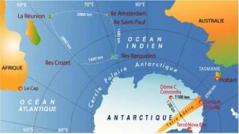
Le navire français Marion Dufresne 2 réalise cinq rotations par an au départ de la Réunion. Ces rotations permettent de ravitailler les bases des Terres australes et antarctique françaises (TAAF) dans l’Océan Indien (dont Crozet, Kerguelen et Amsterdam) et d’en assurer la logistique; elles permettent aussi le transport de personnes (notamment celui des scientifiques). Une rotation dure environ 4 semaines. C’est la rotation OP3 qui nous amène aux Kerguelen. (http://www.taaf.fr)
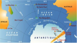
Trajet d’une rotation passant par Crozet, Kerguelen et Amsterdam (taaf_IPEV_00e46)
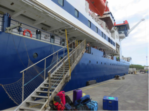
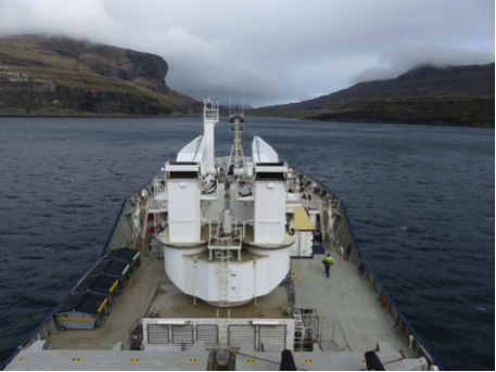
Départ de La Réunion, le 13/11 à bord du Marion Dufresne
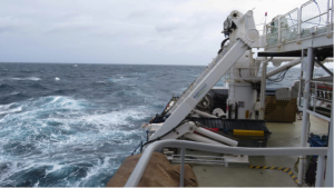
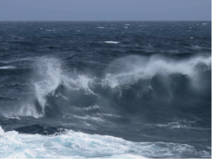
Sa 14 ; di 15 calme. Encore dans les eaux tropicales ; lu 16 – ma 17- me 18 (de plus en plus frais, on passe la convergence subtropicale ; grosse houle … mais rien d’insupportable… Je m’attendais aux pires tempêtes! Entrée progressive dans les 40èmes rugissants (Les Kerguelen se trouvent à la marge des 50èmes hurlants … des précisions qui laissent rêveur !)
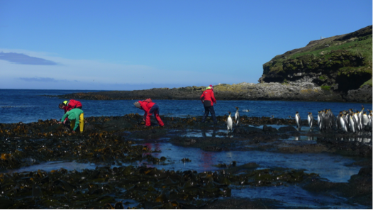
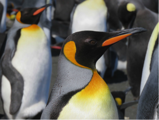
Me 18/11 : Ile de la Possession (Archipel de Crozet): débarquement en hélicoptère à la base Alfred Faure, on passe la journée sur l’ile, on rejoint Port-Alfred (Baie du Marin, platier du Bollard), pour récolter des patelles (étudiées par E. Poulin, notre collègue chilien). Temps venteux mais soleil magnifique. Curieux, les manchots royaux nous observent de près !

Crozet: récolte de patelles à marée basse (Photos J. Fournier)
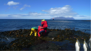
Crozet: récolte de patelles à marée basse (Photos J. Fournier)
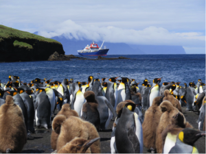
Crozet: manchots royaux

Ve 20/11 : On reprend la mer- Cap sur Kerguelen. On ne s’ennuie pas à bord… Samedi 21/11 de 9h30 à 11h exposé par le médecin de bord sur les 1ers soins en cas d’urgence – théorie; à 11h, exposé de notre équipe sur nos recherches aux Kerguelen; 14h-15h30: 1ers soins – ‘pratique’ (instructif). Dimanche 22/11 : navigation en eaux calmes, acrobaties des albatros (sourcils noirs et grand albatros), des pétrels et des damiers du Cap autour du bateau.
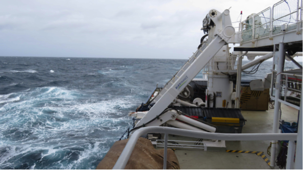
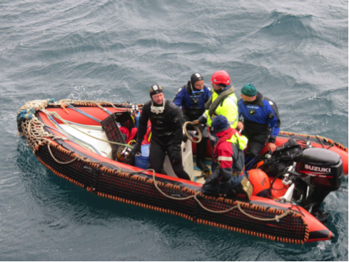
Lu 23/11: Port Christmas – Voici enfin la côte nord de Grande Terre, l’ile principale de l’archipel des Kerguelen. Débarquement en hélico de l’équipe TREKKER, qui va traverser l’ile du nord au sud (elle va rejoindre Port-aux-Français, le 17/12 : http://www.latitudes-nord.fr/carnets-et-photos/trekker-traversee-de-l-ile-de-kerguelen), et 1ère plongée (depuis le zodiac du Marion Dufresne) pour deux membres de notre équipe, Thomas Saucède et Gilles Marty (T° de l’eau: 5°C) – au programme : relevé et remplacement des thermomètres et des placettes de colonisation ; les oursins ne seront pas au rendez-vous. Le bateau poursuit sa route vers le sud en longeant Grande Terre, encore une étape avant Port- aux-Français (PAF).
Arrivée à Port Christmas

Mise à l’eau du zodiac
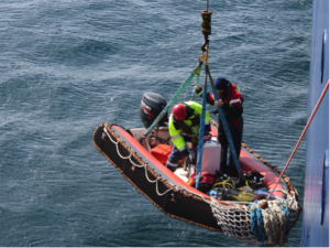
Retour de plongée

Ma 24/11: Port Couvreux – Dans la brume se dessine sur la côte ce qui reste d’une ferme construite vers 1912 pour y élever des moutons, une entreprise qui périclitera après plusieurs rebondissements tragiques, les derniers habitants seront évacués en 1931 …
Du matériel est héliporté vers une des cabanes de Grande Terre; une quarantaine de cabanes y sont réparties; elles permettent aux scientifiques de rester plusieurs jours sur le terrain pour y effectuer des observations. Malheureusement pour nous, la plongée à Port Couvreux est annulée en raison des mauvaises conditions météo.
L’hélicoptère en action

Port Couvreux
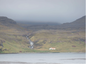
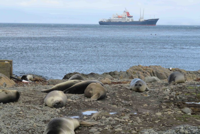
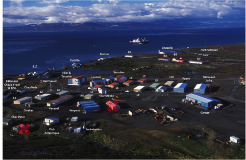
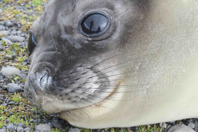
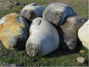
Port-aux-Français, Kerguelen, le 25 novembre. Débarquement en hélicoptère, rotations hélico-bateau toutes les 5 min, cela va très vite, à peine le temps de réaliser qu’on est en vol … On atterrit, pas très loin de ‘nos’ premiers éléphants de mer! Transition rapide entre les 10 jours de mer et la terre ferme. Il y a beaucoup de vent et une jolie lumière qui joue avec les couleurs, des éléphants de mer omniprésents et notamment des bonbons (jeunes éléphants de mer dans le jargon local) et… des lapins qui gambadent une peu partout! Paysages à la végétation rase de toundra, où vert, jaune et ocre dominent mais leurs nuances varient sans arrêt avec la lumière changeante.
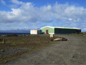
Les déchargements à partir de Marion Dufresne sont subitement interrompus, en cause, le vent (c’est peu dire, difficile de marcher!). Le chaland (‘L’Aventure II’) revient s’amarrer devant le port et l’hélicoptère retourne sur le pont du Marion. La mer moutonne et les rafales de vent en balaient la surface formant de larges bandes ridées bleues presque noires. Notre matériel est encore à bord. Le vent devrait mollir demain. C’est la météo qui dicte les activités, une règle incontournable ici. Pour patienter, nous avons installé notre labo dans le bâtiment BIOMAR qui héberge tous les scientifiques, et récupéré du matériel laissé par la mission PROTEKER de l’année dernière. La base de Port-aux-Français (PAF) est peuplée d’hivernants, de divers techniciens, de scientifiques de passage, …). La vie à PAF est organisée et confortable, avec ses codes et son langage … abréviations et surnoms avec lesquels il faut se familiariser. Je découvre que je suis une biolo (biologiste), qu’il y a un bib et un bibou (médecin et aide médecin), un pateux (boulanger) et des bouts de bois (menuisiers), que PAF est un village comportant outre les bâtiments de logements (L1, L2,… où les gens sont généralement regroupés par corps de métier), une bibliothèque, un restaurant (Tyker), un bar (Totoche), une salle de projection (cineker), des bâtiments techniques de toutes sortes (BT) notons que parmi ces derniers, il y a kerpou où se fait le tri des ordures (une bonne partie d’entre-elles sont rapatriées)
… Bientôt les premières plongées et les oursins! Affaire à suivre…
Vue aérienne de PAF (photo TAAF)

Le bâtiment Biomar
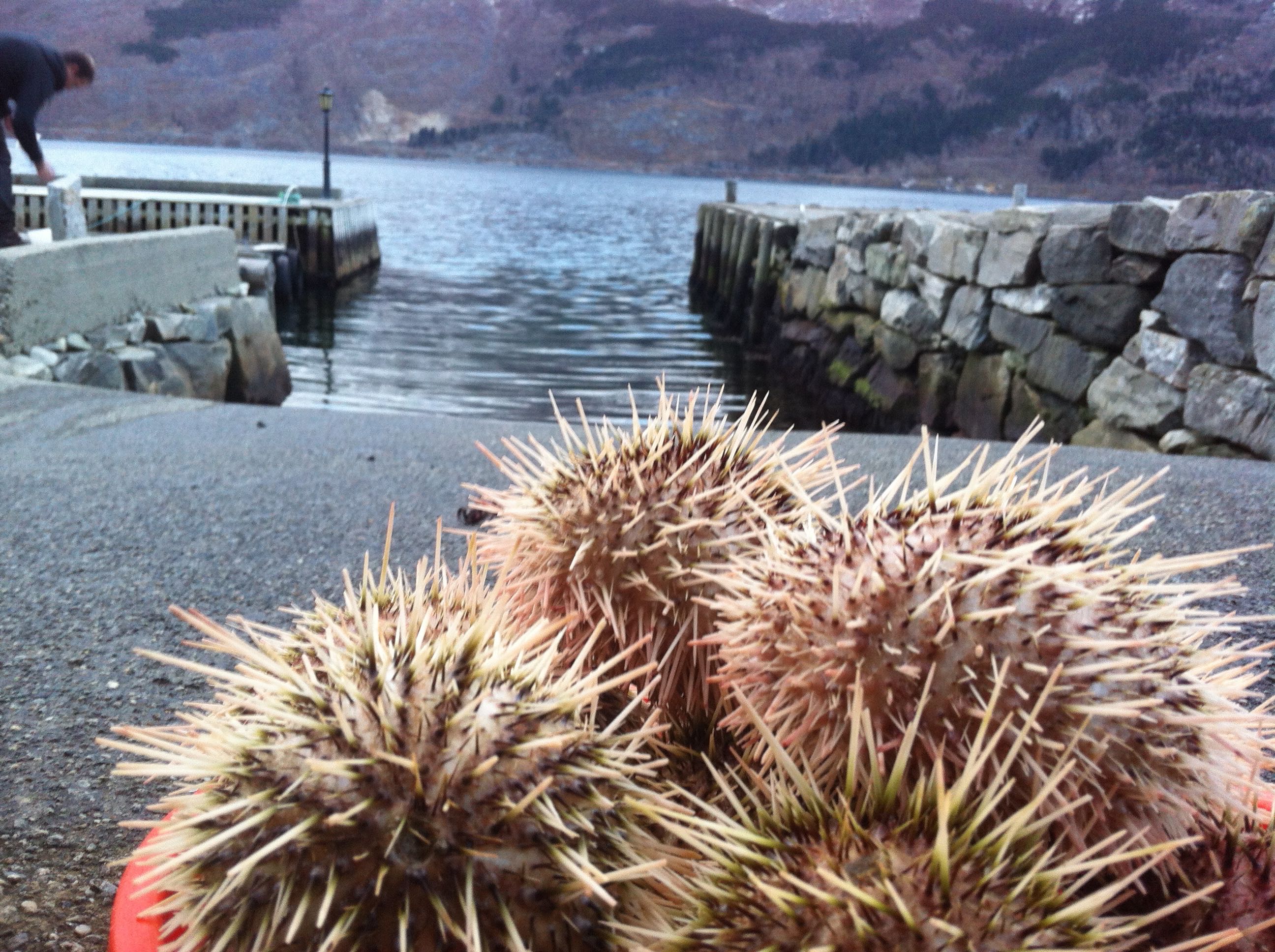
Premières récoltes à marée basse à PAF…
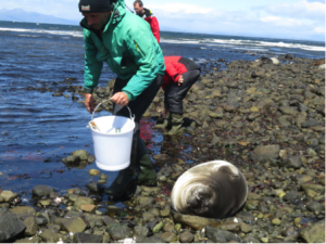
Et nos voisins …
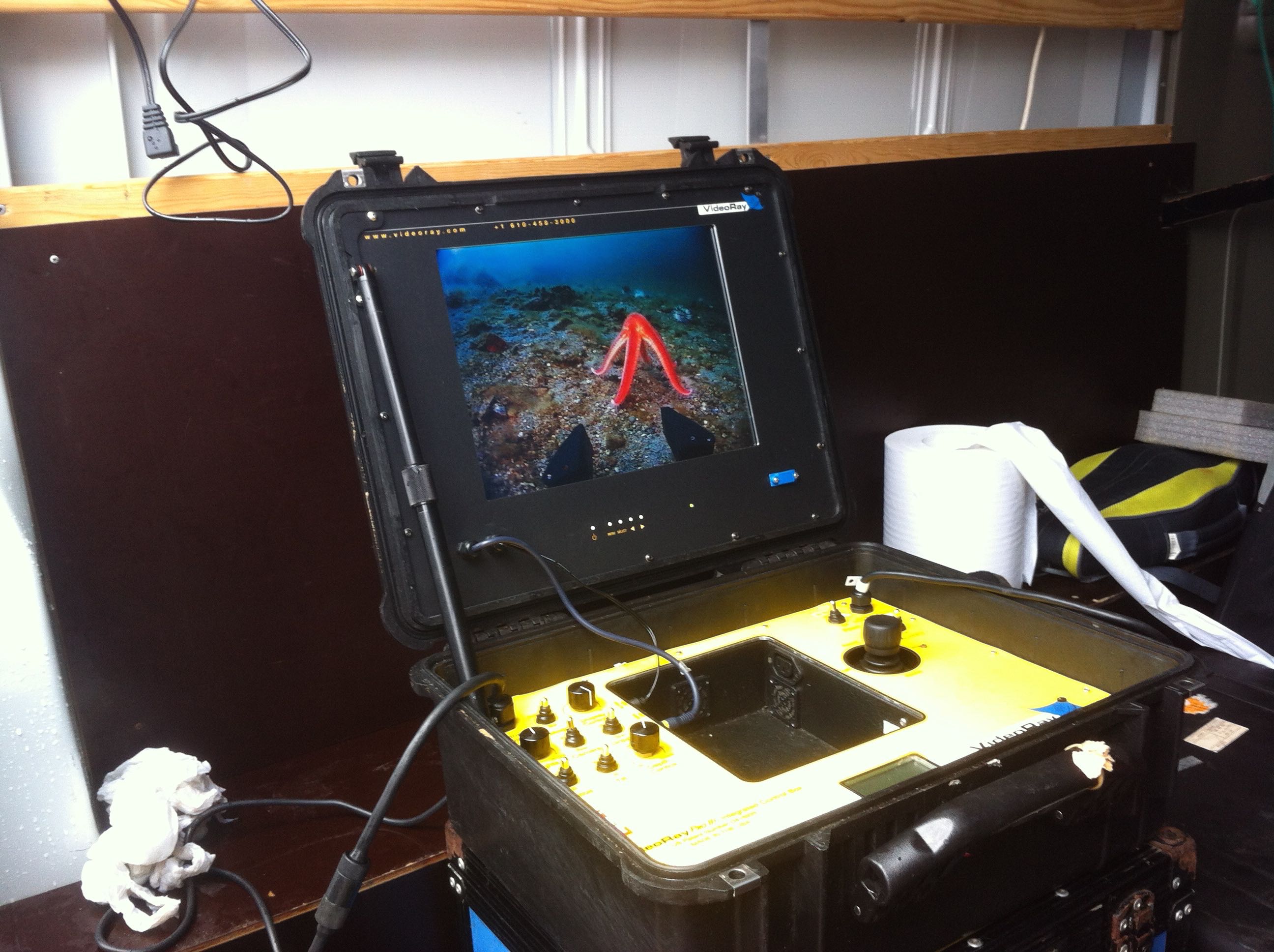
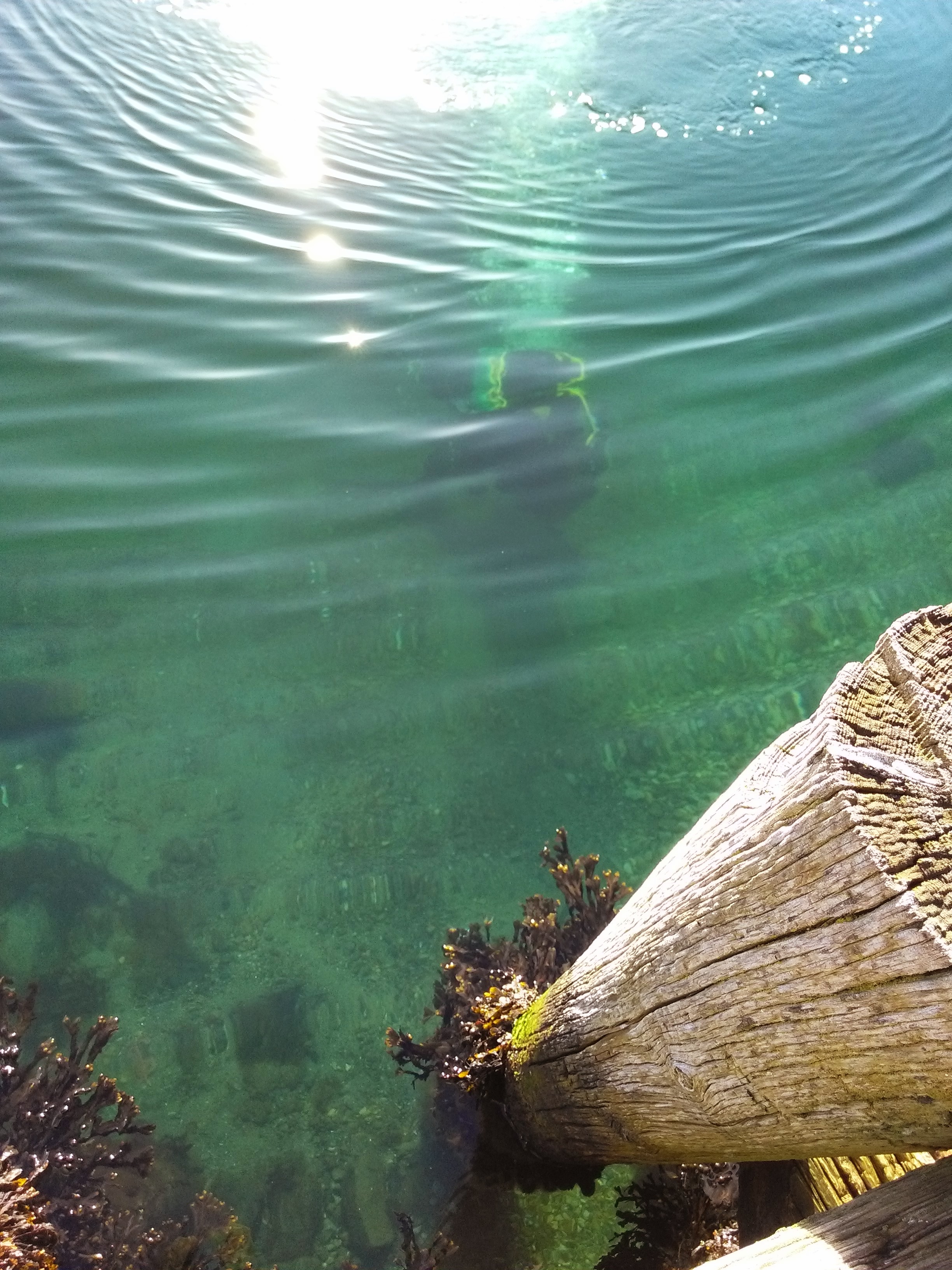
Premières plongées … Premiers oursins !
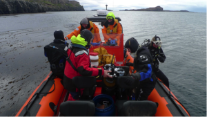
A bord du zodiac Commerson (Ile Haute) – Photo J. Fournier
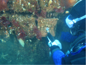
Relevé des placettes de colonisation- Photo E. Poulin
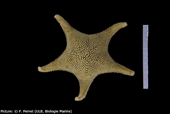
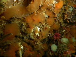
Ctenocidaris nutrix – Photo E. Poulin
Description du projet PROTEKER
http://www.proteker.net/?lang=fr
http://www.proteker.net/-PROTEKER-programme-IPEV-1044-.html?lang=en

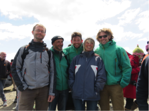
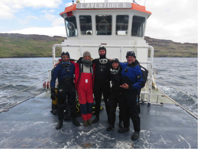
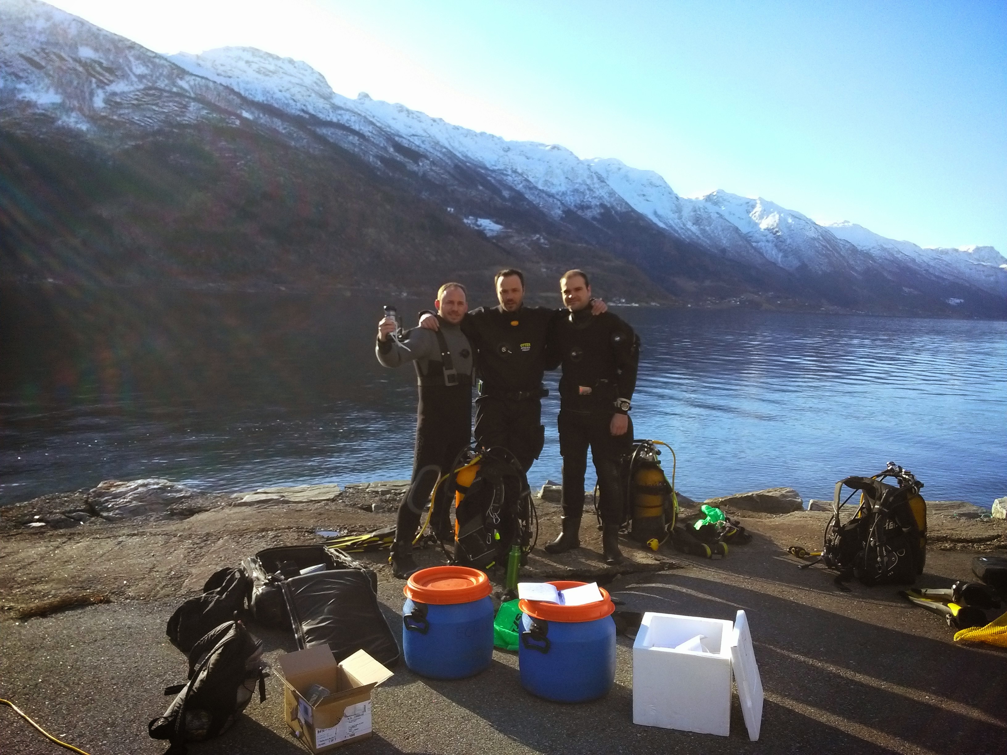
L’équipe PROTEKER 2015 à bord du chaland, L’Aventure II
De gauche à droite : Gilles MARTY (TAAF), Chantal De Ridder (ULB), Thomas Saucède (uB), Salomé Fabri-Ruiz (uB, ULB) et Jérôme Fournier (CNRS MNHN)
L’équipe comporte aussi deux autres agents des TAAF indispensables: Romain Vergé, pilote du Commerson et Luc Baudot, son aide efficace !
De gauche à droite : Thomas Saucède (uB), Gilles MARTY (TAAF), Luc Baudot (TAAF), Chantal De Ridder (ULB), Romain Vergé (TAAF), au terme de la mission