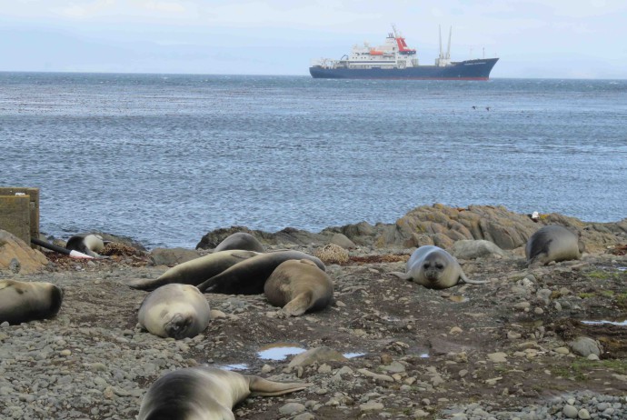
The RAATD workshop

This week, Bruno Danis is attending the fourth RAATD workshop, hosted at the CESAB (Center for Synthesis and Analysis of Biodiversity), in Aix-en-Provence. 10 participants from 7 countries are attending the meeting.

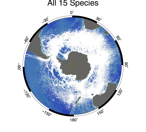
The Retrospective Analysis of Antarctic Tracking Data (RAATD) is a multispecies assessment of habitat use of Antarctic meso- and top predators in the Southern Ocean based on existing animal tracking data to identify Areas of Ecological Significance, i.e. regions that are important for foraging to a range of predators and which, consequently, present an important biodiversity. RAATD was initiated by the SCAR Expert Group on Birds and Marine Mammals (EG-BAMM), and provides (i) a greater understanding of fundamental ecosystem processes in the Southern Ocean, (ii) facilitate future projections of predator distributions under varying climate regimes, and (iii) provide input into spatial management planning decisions for management authorities such as the Convention on the Conservation of Antarctic Marine Living Resources. The synopsis of multi-predator tracking data will also expose potential gaps of data coverage in regions or seasons that are important but underrepresented, possibly due to biases in the spatial, temporal, or taxonomic distribution of research effort. We have collated all available tracking data by research groups that worked in the Antarctic since the 1990s. We have then establish a preliminary publicly accessible repository of these data. The final publicly available repository will only have the raw data that data holders have agreed to share and will contain data from almost 40 contributors from 12 national Antarctic programs. The dataset contains data on 17 predator species, with more than 3400 individual animals, and more than 2.5 million data points. We will also share the outputs of the project, including filtered and processed versions of these data, and habitat model outputs.


Camille is off to the ACE Expedition

This season 2017, Camille Moreau, PhD student at the Universities of Brussels (ULB) and Dijon, is joining a major Swiss-led research expedition circum-navigating the Antarctic: the ACE (Antarctic Circumnavigation Expedition).

In the framework of his PhD project, Camille will take part as a member of the ASCCC (Antarctic Seabed Carbon Capture Change) team gathering scientists from master students to senior scientists. Their research will investigate the importance of sea bed animals in carbon cycling and how climate change will impact these processes in the Southern Ocean.

The project is led by David Barnes, a marine biologist at the British Antarctic Survey and zoology/ecology professor at the University of Cambridge. He took part in the first leg of the expedition, from Cape Town to Hobart. Camille will join the team in Hobart, Tasmania for the second leg of the expedition, a which will take the ship to Punta Arenas, Chile. The team will have the opportunity to visit rarely studied sub-Antarctic islands (Macquarie, Balleny, Scott, Peter the 1st and Diego Ramirez). They will also carry on researches around the Mertz Glacier in Antarctica.

Collection of benthic organisms using a trawl, investigation of marine debris ashore and use of a remotely operated vehicle (ROV) will organise their daily life for the next few weeks.

For more information regarding the expedition and the ASCCC project follow this link or follow their progress on twitter @ACE_Expedition and @asccc_news.

PhD scholarship available at the VUB, Marine Biology Lab, in the framework of the RECTO project

PhD scholarship (4 years) in molecular ecology at the Vrije Universiteit Brussel (VUB), Department of Biology, Marine Biology Lab, Belgium.

We are searching for a highly motivated PhD student that will work on evolution, population genetics and connectivity in Antarctic sea stars utilising a genomics approach (DNA barcoding, microsatellites and next generation sequencing) in the framework of the interdisciplinary project

Refugia and Ecosystem Tolerance in the Southern Ocean (RECTO).

Because of its long history and geographic isolation, the Southern Ocean (SO) provides a natural laboratory for research on evolution and biodiversity. Confronted with fast-paced environmental changes, biota in Antarctic ecosystems are strongly challenged and face three possible outcomes: adaptation, migration or extinction. Past glaciation periods have already forced marine zoobenthos of the SO into refugia, being either ice-free continental shelf areas, the deep sea or sub- or peri- Antarctic regions, followed by recolonization when the ice retreated. In a multidisciplinary approach and involving all major Belgian research groups studying evolution and diversity of SO faunas, RECTO will strive at understanding how such past events have driven diversification and adaptation in different animal groups and how these can be applied as proxies to understand the contemporary situation and predict future scenarios.

The Marine Biology Lab at the VUB specialises in research on molecular ecology of marine fauna from the poles to the tropics and from invertebrates to fishes. In the new collaborative research project RECTO the evolutionary history of Antarctic sea stars will be studied.

More details here: PhD scholarship advertisement

Un coup d’oeil a la biodiversite des fonds marins Antarctiques

Que faisons-nous?

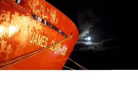
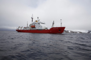
Nous sommes à bord du JCR, le James Clark Ross, un navire de recherche océanographique Britannique, qui doit son nom à un explorateur polaire Anglais.

JCR

Le James Clark Ross, a Signy Island. Photo: Bruno Danis

Le but de notre mission est de faire un inventaire, une liste, de tous les animaux qui vivent au fond de la mer (on les appelle les animaux benthiques), dans la région des Orcades du Sud. Ces îles se trouvent entre l’Amérique du Sud et la Péninsule Antarctique, et nous pensons que leur biodiversité doit être protégée. Pour cela, il est important de répertorier tous les animaux qui s’y trouvent (et beaucoup n’ont pas encore été décris), avec comme idée de pouvoir revenir plus tard pour un nouvel inventaire, qui permettra de déceler des changements dûs aux changements de l’environnement.

Comment faisons-nous?

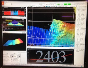
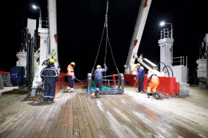
Nous sommes dans une région qui a été relativement peu explorée. La seule manière d’inventorier les animaux qui nous intéresse est de les remonter à la surface. Nous utilisons pour cela des engins semblables à ceux qui sont utilisés par les pêcheurs, mais beaucoup plus petits, pour éviter d’abîmer les fonds. Nous utilisons notamment un AGT (Agassiz Trawl – Chalut Agassiz, du nom de son inventeur) et un traîneau EBS (Epibenthic sledge), qui permet de récolter les animaux qui sont près du fond. Avant de lancer les engins de récolte, nous “scannons” le fond, à l’aide d’un SWATH (qui permet d’avoir une image 3D du fond, très précise), qui fonctionne sur le principe de l’écholocalisation, comme les dauphins ou les chauve-souris… Nous utilisons ensuite une caméra benthique, qui nous permet de prendre de belles photos du fond. Une fois certains que les conditions sont réunies, nous déployons les engins depuis le pont arrière, et déroulons les cables pour atteindre des profondeurs de 500, 750, 1000, 1500 et 2000 m.

Swath3-300x233

Capture d’ecran du SWATH en action. Les couleurs sont proportionnelles a la profondeur (bleu: plus profond; rouge: moins profond). Photo: Louise Allcock.

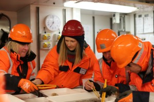
Nous remontons ensuite les engins et trions et identifions tous les animaux, ce qui représente un travail très intense, que nous réalisons en équipe.

AGT

Lancement du chalut Agassiz depuis le pont arriere du JCR. Photo: Bruno Danis

Tri des echantillons

Une fois a bord, les echantillons sont tries dans le “WetLab”. Photo: Richard Turner

Qu’avons nous trouvé jusqu’ici?

Nous sommes à la moitié de l’expédition, et les différents endroits où nous avons travaillé (que l’on appelle des stations) montrent une diversité très différente. Certaines stations sont relativement pauvres en animaux, mais d’autres sont très riches, et nous avons probablement déjà récolté un nombre important de nouvelles espèces! Ce que nous accumulons comme information devra nous permettre de bien choisir les endroits qui doivent être protégés.

Biodiversity

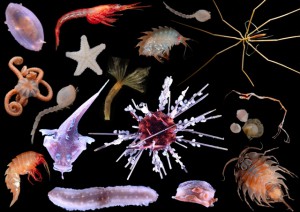
Quelques animaux recoltes au cours de la campagne. Photos: Claudio Ghiglione, Camille Moreau, Helena Wiklund, Cath Waller


Pour en savoir plus… suivez le hashtag #SoAntEco sur Twitter


PROTEKER – Quelques moments de la campagne 2015 par Chantal DE RIDDER

Le navire français Marion Dufresne 2 réalise cinq rotations par an au départ de la Réunion. Ces rotations permettent de ravitailler les bases des Terres australes et antarctique françaises (TAAF) dans l’Océan Indien (dont Crozet, Kerguelen et Amsterdam) et d’en assurer la logistique; elles permettent aussi le transport de personnes (notamment celui des scientifiques). Une rotation dure environ 4 semaines. C’est la rotation OP3 qui nous amène aux Kerguelen. (http://www.taaf.fr)
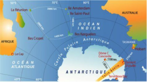
Trajet d’une rotation passant par Crozet, Kerguelen et Amsterdam (taaf_IPEV_00e46)
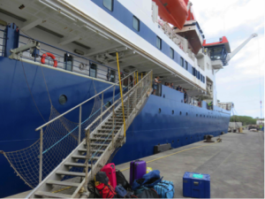
Trajet d’une rotation passant par Crozet, Kerguelen et Amsterdam (taaf_IPEV_00e46)

Départ de La Réunion, le 13/11 à bord du Marion Dufresne

Départ de La Réunion, le 13/11 à bord du Marion Dufresne

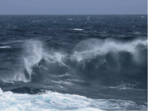
Sa 14 ; di 15 calme. Encore dans les eaux tropicales ; lu 16 – ma 17- me 18 (de plus en plus frais, on passe la convergence subtropicale ; grosse houle … mais rien d’insupportable… Je m’attendais aux pires tempêtes! Entrée progressive dans les 40èmes rugissants (Les Kerguelen se trouvent à la marge des 50èmes hurlants … des précisions qui laissent rêveur !)
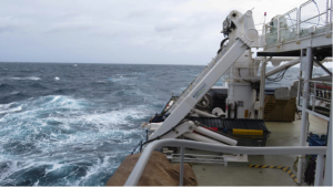
Untitled3

Untitled4

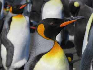
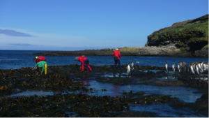
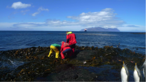
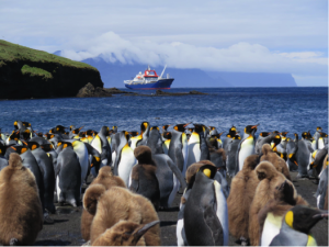
Me 18/11 : Ile de la Possession (Archipel de Crozet): débarquement en hélicoptère à la base Alfred Faure, on passe la journée sur l’ile, on rejoint Port-Alfred (Baie du Marin, platier du Bollard), pour récolter des patelles (étudiées par E. Poulin, notre collègue chilien). Temps venteux mais soleil magnifique. Curieux, les manchots royaux nous observent de près !
Untitled6

Crozet: récolte de patelles à marée basse (Photos J. Fournier)
Untitled5

Crozet: récolte de patelles à marée basse (Photos J. Fournier)
Untitled7

Crozet: manchots royaux

Untitled8

Ve 20/11 : On reprend la mer- Cap sur Kerguelen. On ne s’ennuie pas à bord… Samedi 21/11 de 9h30 à 11h exposé par le médecin de bord sur les 1ers soins en cas d’urgence – théorie; à 11h, exposé de notre équipe  sur nos recherches aux Kerguelen; 14h-15h30: 1ers soins – ‘pratique’ (instructif). Dimanche 22/11 : navigation en eaux calmes, acrobaties des albatros (sourcils noirs et grand albatros),  des pétrels et des damiers du Cap autour du bateau.


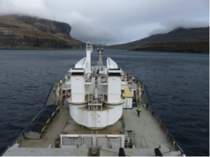
Lu 23/11: Port Christmas – Voici enfin la côte nord de Grande Terre, l’ile principale de l’archipel des Kerguelen. Débarquement en hélico de l’équipe TREKKER, qui va traverser l’ile du nord au sud (elle va rejoindre Port-aux-Français, le 17/12 : http://www.latitudes-nord.fr/carnets-et-photos/trekker-traversee-de-l-ile-de-kerguelen), et 1ère plongée (depuis le zodiac du Marion Dufresne) pour deux membres de notre équipe, Thomas Saucède et Gilles Marty (T° de l’eau: 5°C) – au programme : relevé et remplacement des thermomètres et des placettes de colonisation ; les oursins ne seront pas au rendez-vous. Le bateau poursuit sa route vers le sud en longeant Grande Terre, encore une étape avant Port- aux-Français (PAF).


Arrivée à Port Christmas
Untitled9


Untitled10

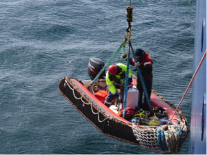
Mise à l’eau du zodiac


Untitled11

Retour de plongée

Untitled12

Ma 24/11: Port Couvreux – Dans la brume se dessine sur la côte ce qui reste d’une ferme construite vers 1912 pour y élever des moutons, une entreprise qui périclitera après plusieurs rebondissements tragiques, les derniers habitants seront évacués en 1931 …

Du matériel est héliporté vers une des cabanes de Grande Terre; une quarantaine de cabanes y sont réparties; elles permettent aux scientifiques de rester plusieurs jours sur le terrain pour y effectuer des observations. Malheureusement pour nous, la plongée à Port Couvreux est annulée en raison des mauvaises conditions météo.

L’hélicoptère en action

L’hélicoptère en action

Port Couvreux
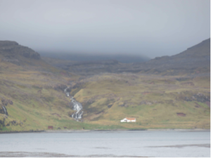
Port Couvreux

Port-aux-Français, Kerguelen, le 25 novembre. Débarquement en hélicoptère, rotations hélico-bateau toutes les 5 min, cela va très vite, à peine le temps de réaliser qu’on est en vol … On atterrit, pas très loin de ‘nos’ premiers éléphants de mer! Transition rapide entre les 10 jours de mer et la terre ferme. Il y a beaucoup de vent et une jolie lumière qui joue avec les couleurs, des éléphants de mer omniprésents et notamment des bonbons (jeunes éléphants de mer dans le jargon local) et… des lapins qui gambadent une peu partout! Paysages à la végétation rase de toundra, où vert, jaune et ocre dominent mais leurs nuances varient sans arrêt avec la lumière changeante.

Les déchargements à partir de Marion Dufresne sont subitement interrompus, en cause, le vent (c’est peu dire, difficile de marcher!). Le chaland (‘L’Aventure II’) revient s’amarrer devant le port et l’hélicoptère retourne sur le pont du Marion. La mer moutonne et les rafales de vent en balaient la surface formant de larges bandes ridées bleues presque noires. Notre matériel est encore à bord. Le vent devrait mollir demain. C’est la météo qui dicte les activités, une règle incontournable ici. Pour patienter, nous avons installé notre labo dans le bâtiment BIOMAR qui héberge tous les scientifiques, et récupéré du matériel laissé par la mission PROTEKER de l’année dernière. La base de Port-aux-Français (PAF) est peuplée d’hivernants, de divers techniciens, de scientifiques de passage, …). La vie à PAF est organisée et confortable, avec ses codes et son langage … abréviations et surnoms avec lesquels il faut se familiariser. Je découvre que je suis une biolo (biologiste), qu’il y a un bib et un bibou (médecin et aide médecin), un pateux (boulanger) et des bouts de bois (menuisiers), que PAF est un village comportant outre les bâtiments de logements (L1, L2,… où les gens sont généralement regroupés par corps de métier), une bibliothèque, un restaurant (Tyker), un bar (Totoche), une salle de projection (cineker), des bâtiments techniques de toutes sortes (BT) notons que parmi ces derniers, il y a kerpou où se fait le tri des ordures (une bonne partie d’entre-elles sont rapatriées)

… Bientôt les premières plongées et les oursins! Affaire à suivre…

Vue aérienne de PAF (photo TAAF)
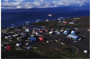
Vue aérienne de PAF (photo TAAF)

Le bâtiment Biomar
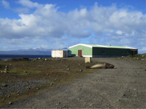
Le bâtiment Biomar

Premières récoltes à marée basse à PAF…
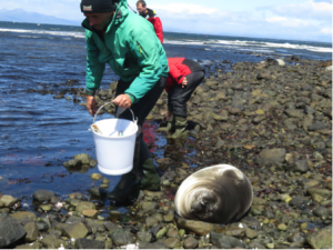
Premières récoltes à marée basse à PAF…

Et nos voisins …
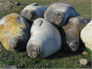
Et nos voisins ...

Premières plongées … Premiers oursins !

A bord du zodiac Commerson (Ile Haute) – Photo J. Fournier
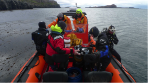
A bord du zodiac Commerson (Ile Haute) - Photo J. Fournier

Relevé des placettes de colonisation- Photo E. Poulin
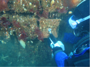
Relevé des placettes de colonisation- Photo E. Poulin

Ctenocidaris nutrix – Photo E. Poulin
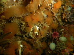
Ctenocidaris nutrix - Photo E. Poulin

Description du projet PROTEKER

http://www.proteker.net/?lang=fr

http://www.proteker.net/-PROTEKER-programme-IPEV-1044-.html?lang=en
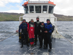
L’équipe PROTEKER 2015 à bord du chaland, L’Aventure II De gauche à droite : Gilles MARTY (TAAF), Chantal De Ridder (ULB), Thomas Saucède (uB), Salomé Fabri-Ruiz (uB, ULB) et Jérôme Fournier (CNRS MNHN)

L’équipe PROTEKER 2015 à bord du chaland, L’Aventure II
De gauche à droite : Gilles MARTY (TAAF), Chantal De Ridder (ULB), Thomas Saucède (uB), Salomé Fabri-Ruiz (uB, ULB) et Jérôme Fournier (CNRS MNHN)


L’équipe comporte aussi deux autres agents des TAAF indispensables: Romain Vergé, pilote du Commerson et Luc Baudot, son aide efficace !
De gauche à droite : Thomas Saucède (uB), Gilles MARTY (TAAF), Luc Baudot (TAAF), Chantal De Ridder (ULB), Romain Vergé (TAAF), au terme de la mission
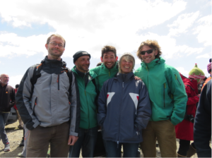
L’équipe comporte aussi deux autres agents des TAAF indispensables: Romain Vergé, pilote du Commerson et Luc Baudot, son aide efficace ! De gauche à droite : Thomas Saucède (uB), Gilles MARTY (TAAF), Luc Baudot (TAAF), Chantal De Ridder (ULB), Romain Vergé (TAAF), au terme de la mission
Projet PROTEKER

Le projet PROTEKER est un programme pilote qui a pour objectif de constituer une une ligne de base pour le suivi
et l’évaluation des changements climatiques attendus sur les écosystèmes marins côtiers des Kerguelen. Il doit permettre l’inventaire (observation, échantillonnage, systématique et analyses génétiques) et le suivi (instrumentation, observation, échantillonnage, analyses trophiques et isotopiques) de ces écosystèmes. Il a aussi pour ambition finale de fournir des critères scientifiques pour les politiques de protection et de conservation des environnements côtiers des Kerguelen. La première phase du projet (2011-2014) a permis de réunir toutes les anciennes données disponibles et de sélectionner et instrumenter des stations de référence pour la mise en oeuvre d’une seconde phase plus opérationnelle. Cette seconde phase consiste prioritairement en un suivi (relevé des instruments installés, observations et prélévements associés dans le cas des placettes de colonisation) des sites, en la cartographie des habitats benthiques associés (sonar, ROV et prélévements en plongée) et en un renforcement des mesures d’observations (instrumentation et caractérisations génétiques, trophiques et écologiques de taxons indicateurs). Les résultats attendus doivent permettre de produire des modèles de distribution des habitats et de la biodiversité marine côtière des Kerguelen ainsi que de leur sensibilité aux changements environnementaux attendus (analyses éco-physiologiques – pH, tempérautre – réalisées sur base à BIOMAR).

vERSO Team arrives at DDU

The vERSO team has finally arrived at the Dumont D’Urville station (Terre Adélie, Antarctica), after crossing the Southern Ocean onboard the IPEV’s RV Astrolabe. Here are their first impressions (translated from French):

“I’m finally installed at the Dumont d’Urville (DDU) station in Terre Adélie, part of the  “Terres Australes et antarctiques françaises” (TAAFs).

It took me 13 days to get their:  2,5 days in the planes, 4 days waiting in Hobart (Tasmania) awaiting the fixing of the ship’s generator, and 6 days at sea, on one of the most unconfortable ships I’ve ever been onboard, the Astrolabe. Even if the weather was good, the ship would roll, up to 35° on both sides! When you’re in such a roller coaster, the only things you can do is avoid getting sea sick and trying not to bang yourself everywhere… Little sleep, as we are constantly rolling from one side to the other in our berths. On the bright side, beautiful albatrosses are following us along the way.

Once arrived at DDU, the transfer to the station is carried out using helicopters, the sea ice extending up to 28km from the station. The helicopter carry the equipement (up to 1T per rotation). After two days, we were able to gather our personal equipment and part of our research and diving gear.

Firs sounding show that the sea ice thickness in the places where we are planning to dive is around  2 to 3m!

The station is located in a beautiful area, where I meet Adélie penguins, fulmars and snow petrels every day. From my room, I have a view on the continental glacier (l’Astrolabe) and on penguin colonies (noisy and smelly!). The logistics here are impressive, and we received a lot of lab space. We still need to find a solution to bring sea water to the container where we will be running acidification experiments in controlled conditions. Our only fear now is that time is flying by extremely quickly!

Wishing you the best for the end of the year,

Philippe”


The SCAR Biogeographic Atlas of the Southern Ocean

_77118968_photo-48

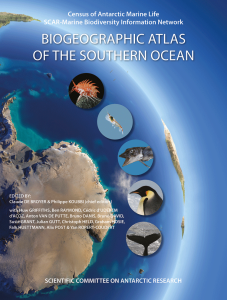
The SCAR Biogeographic Atlas of the Southern Ocean has been officially launched at the SCAR Open Science Conference in Auckland, New Zealand. The Marine Biology Lab of the ULB has been heavily involved in the effort, mainly in the edition, data mobilization and writing of the book.

You can download the first chapter of the Atlas as a preview.

Below is the press release, as prepared by the British Antarctic Survey.

The new Atlas, providing the most thorough audit of marine life in the Southern Ocean, is published this week by the Scientific Committee on Antarctic Research (SCAR). Leading marine biologists and oceanographers from all over the world spent the last four years compiling everything they know about ocean species from microbes to whales.

It’s the first time that such an effort has been undertaken since 1969 when the American Society of Geography published its Antarctic Map Folio Series.

In an unprecedented international collaboration 147 scientists from 91 institutions across 22 countries (Australia, Belgium, Brazil, Canada, Chile, Denmark, France, Germany, Ireland, Italy, Japan, the Netherlands, New Zealand, Norway, Poland, Portugal, Russia, South Africa, Spain, Switzerland, the UK and the USA) combined their expertise and knowledge to produce the new Biogeographic Atlas of the Southern Ocean.

More than 9000 species are recorded, ranging from microbes to whales. Hundreds of thousands of records show the extent of scientific knowledge on the distribution of life in the Southern Ocean. In 66 chapters, the scientists examine the evolution, physical environment, genetics and possible impact of climate change on marine organisms in the region.

Chief editor, Claude De Broyer, of the Royal Belgian Institute of Natural Sciences, said:

“This is the first time that all the records of the unique Antarctic marine biodiversity, from the very beginnings of Antarctic exploration in the days of Captain Cook, have been compiled, analysed and mapped by the scientific community. It has resulted in a comprehensive atlas and an accessible database of useful information on the conservation of Antarctic marine life.”

The data, and expert opinions, in the Atlas will help inform conservation policy, including the debate over whether or not to establish marine protected areas in the open ocean. Sophisticated environmental models coupled with existing species distribution data provide a valuable outlook on the possible future distribution of key species as they adapt to climate change.

New advances in genetics have shed light on some of the best known species from the Antarctic sea floor. The giant isopod crustacean Glyptonotus antarcticus is one of those. The animal lives on the edge of the continent at depths of up to 600 metres. Previously considered to be a single species with a circumpolar distribution, molecular barcoding suggests it may, in reality, be a group with up to eleven species inhabiting much smaller geographic regions.

Author, and editor, Huw Griffiths, of the British Antarctic Survey, said:

“The book is unique and contains an amazing collection of information and photos. It’s been an enormous international effort and will serve as a legacy to the dedicated team of scientists who have contributed to it. The Atlas is a must-read for anyone interested in the animals living at the end of the Earth.”

The Atlas contains around 100 colour photos and 800 maps. It will be launched at the SCAR 2014 Open Science Conference in Auckland, New Zealand on Monday 25th August.

BIOMAR Lab hosting mARS workshop

This week, we are hosting another workshop to scope out the next steps for the Microbial Antarctic Resources System (mARS) , a followup project from SCAR’s Expert Group on Antarctic Biodiversity Informatics (EG-ABi).

The participants include Alison Murray (Desert Research Institute), Anton Van de Putte (biodiversity.aq), Nabil Youdjou (biodiversity.aq) and Bruno Danis (Marine Biology Lab). PhD students from the CCAMBIO project also attended, as beta-testers.

The Microbial Antarctic Resources System (mARS) is envisioned as an information system dedicated to facilitate the discovery, access and analysis of geo-referenced, molecular microbial diversity (meta)data generated by Antarctic researchers, in an Open fashion. The scope of diversity will encompass all freel-living and host-associated virus, Bacteria, Archaea, and singled-celled Eukarya.

mARS focuses on past, present and future works. It offers a community-driven platform for scientists to publish, document, analyse and share their (meta)data with the broad community for science, conservation and management purposes, in the spirit of the Antarctic Treaty.

This week, we will  be beta-testing the mARS to take it to Step 3, as described in our vision document.
BIOMAR Lab hosting dBASO workshop

atlas_home

This week, we will be hosting an international workshop to scope out the new dynamic Biogeographic Atlas of the Southern Ocean (dBASO), a followup project of SCAR’s Biogeographic Atlas of the Southern Ocean.

At the end of five years of extensive biodiversity exploration and assessment by CAML and the OBIS Antarctic Node (the SCAR Marine Biodiversity Information Network), a new initiative, the multi-authored “SCAR Biogeographic Atlas of the Southern Ocean”, has been established under the aegis of the Scientific Committee on Antarctic Research (SCAR) to provide an up-to-date synthesis of Antarctic and sub-Antarctic biogeographic knowledge and to make available a new comprehensive online resource for visualisation, analysis and modelling of species distribution. It will constitute a major scientific output of CAML and SCAR-MarBIN as well as being a significant legacy of CoML and the International Polar Year to fulfill the needs of biogeographic information for science, conservation, monitoring and sustainable management of the changing Southern Ocean. It will be of direct benefit to the Antarctic Treaty and associated bodies such as the Convention for the Conservation of Antarctic Marine Living Resources.
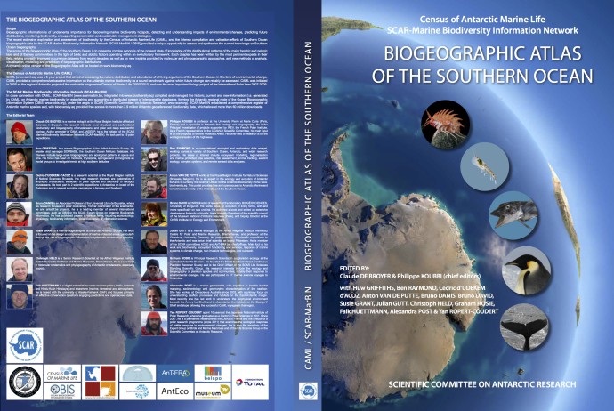
Ten participants from 5 countries (Australia, France, Italy, United Kingdom, Belgium) will be working on the initial development steps to make dBASO go live.