Un coup d’oeil a la biodiversite des fonds marins Antarctiques

Que faisons-nous?

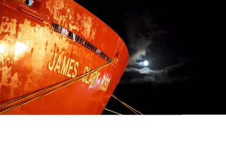
Nous sommes à bord du JCR, le James Clark Ross, un navire de recherche océanographique Britannique, qui doit son nom à un explorateur polaire Anglais.

JCR

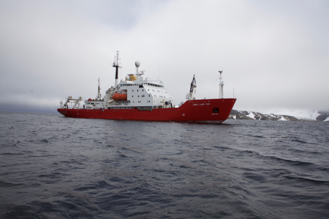
Le James Clark Ross, a Signy Island. Photo: Bruno Danis

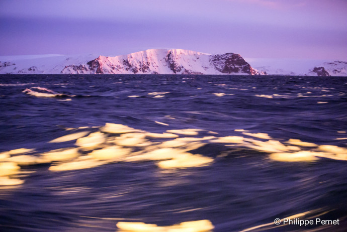
Le but de notre mission est de faire un inventaire, une liste, de tous les animaux qui vivent au fond de la mer (on les appelle les animaux benthiques), dans la région des Orcades du Sud. Ces îles se trouvent entre l’Amérique du Sud et la Péninsule Antarctique, et nous pensons que leur biodiversité doit être protégée. Pour cela, il est important de répertorier tous les animaux qui s’y trouvent (et beaucoup n’ont pas encore été décris), avec comme idée de pouvoir revenir plus tard pour un nouvel inventaire, qui permettra de déceler des changements dûs aux changements de l’environnement.

Comment faisons-nous?

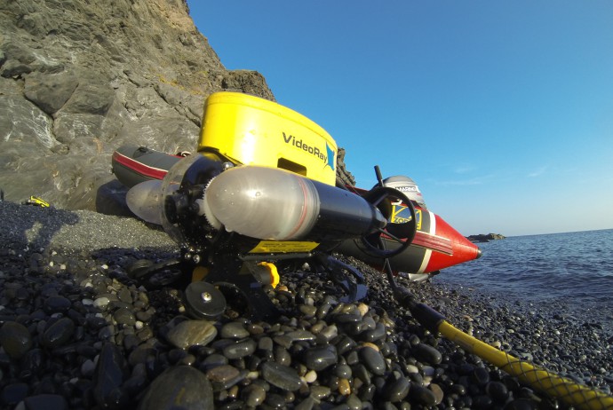
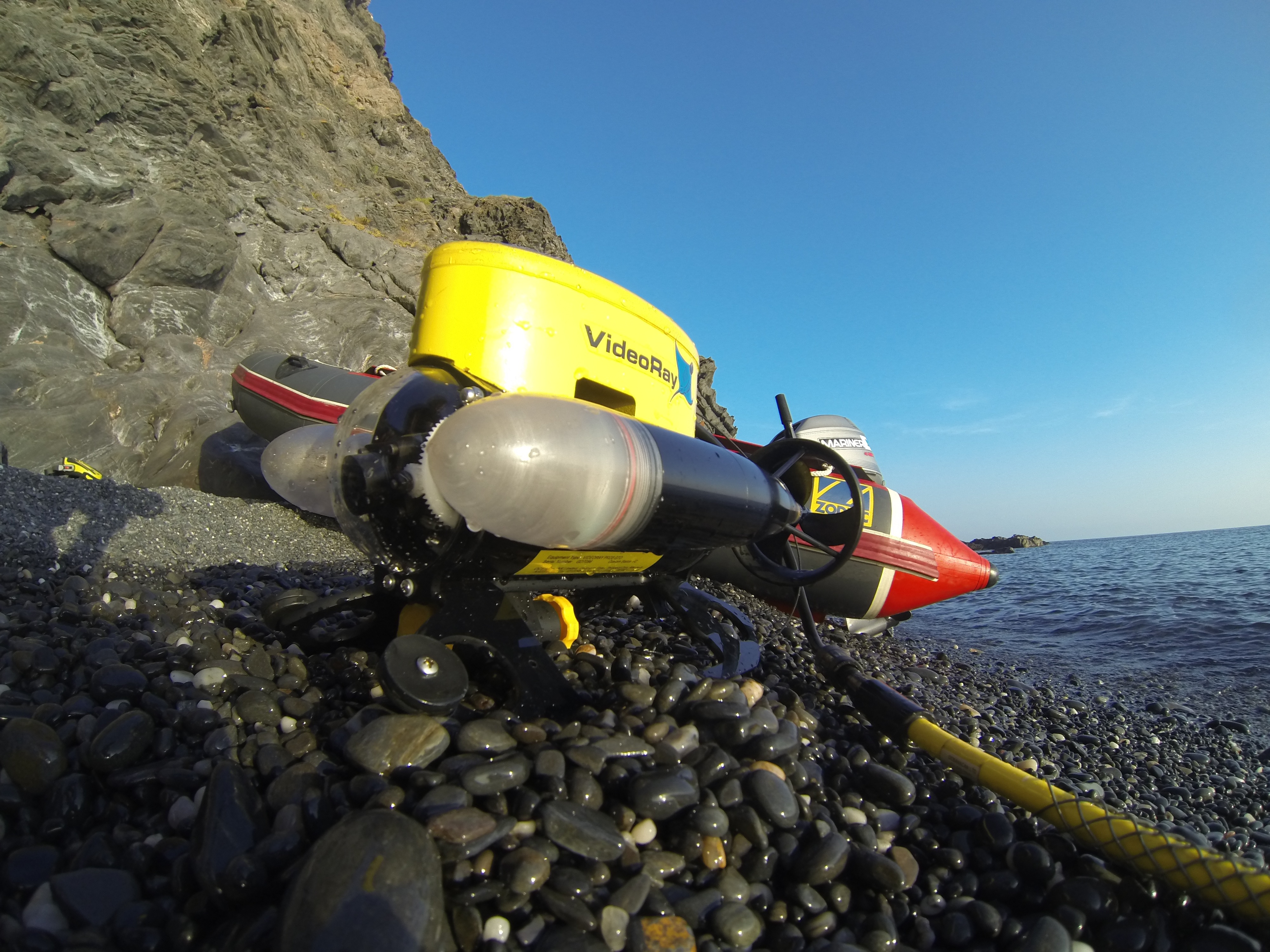
Nous sommes dans une région qui a été relativement peu explorée. La seule manière d’inventorier les animaux qui nous intéresse est de les remonter à la surface. Nous utilisons pour cela des engins semblables à ceux qui sont utilisés par les pêcheurs, mais beaucoup plus petits, pour éviter d’abîmer les fonds. Nous utilisons notamment un AGT (Agassiz Trawl – Chalut Agassiz, du nom de son inventeur) et un traîneau EBS (Epibenthic sledge), qui permet de récolter les animaux qui sont près du fond. Avant de lancer les engins de récolte, nous “scannons” le fond, à l’aide d’un SWATH (qui permet d’avoir une image 3D du fond, très précise), qui fonctionne sur le principe de l’écholocalisation, comme les dauphins ou les chauve-souris… Nous utilisons ensuite une caméra benthique, qui nous permet de prendre de belles photos du fond. Une fois certains que les conditions sont réunies, nous déployons les engins depuis le pont arrière, et déroulons les cables pour atteindre des profondeurs de 500, 750, 1000, 1500 et 2000 m.

Swath3-300x233

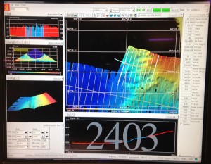
Capture d’ecran du SWATH en action. Les couleurs sont proportionnelles a la profondeur (bleu: plus profond; rouge: moins profond). Photo: Louise Allcock.

Nous remontons ensuite les engins et trions et identifions tous les animaux, ce qui représente un travail très intense, que nous réalisons en équipe.

AGT

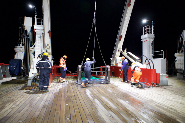
Lancement du chalut Agassiz depuis le pont arriere du JCR. Photo: Bruno Danis

Tri des echantillons

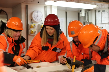
Une fois a bord, les echantillons sont tries dans le “WetLab”. Photo: Richard Turner

Qu’avons nous trouvé jusqu’ici?

Nous sommes à la moitié de l’expédition, et les différents endroits où nous avons travaillé (que l’on appelle des stations) montrent une diversité très différente. Certaines stations sont relativement pauvres en animaux, mais d’autres sont très riches, et nous avons probablement déjà récolté un nombre important de nouvelles espèces! Ce que nous accumulons comme information devra nous permettre de bien choisir les endroits qui doivent être protégés.

Biodiversity

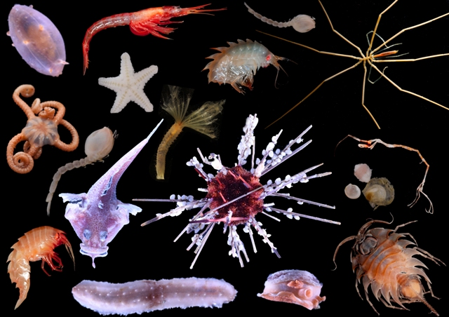
Quelques animaux recoltes au cours de la campagne. Photos: Claudio Ghiglione, Camille Moreau, Helena Wiklund, Cath Waller


Pour en savoir plus… suivez le hashtag #SoAntEco sur Twitter


BIOMAR Lab hosting mARS workshop

This week, we are hosting another workshop to scope out the next steps for the Microbial Antarctic Resources System (mARS) , a followup project from SCAR’s Expert Group on Antarctic Biodiversity Informatics (EG-ABi).

The participants include Alison Murray (Desert Research Institute), Anton Van de Putte (biodiversity.aq), Nabil Youdjou (biodiversity.aq) and Bruno Danis (Marine Biology Lab). PhD students from the CCAMBIO project also attended, as beta-testers.

The Microbial Antarctic Resources System (mARS) is envisioned as an information system dedicated to facilitate the discovery, access and analysis of geo-referenced, molecular microbial diversity (meta)data generated by Antarctic researchers, in an Open fashion. The scope of diversity will encompass all freel-living and host-associated virus, Bacteria, Archaea, and singled-celled Eukarya.

mARS focuses on past, present and future works. It offers a community-driven platform for scientists to publish, document, analyse and share their (meta)data with the broad community for science, conservation and management purposes, in the spirit of the Antarctic Treaty.

This week, we will  be beta-testing the mARS to take it to Step 3, as described in our vision document.

Mission Portman: a short report…

Remediation poster

Poster explaining the ongoing remediation programs in the Bay Portman

A small team from the BIOMAR Lab set a research mission to the Bay of Portman, Spain. The team was composed of Philippe Pernet (technician), three master students (Valérie Rossez, Andrea Garvetto and Maxime Coupremanne) under the supervision of Bruno Danis. The team reached the Bay on October 16th, 2013 for a 10-day stay.

The Bay of Portman was chosen for its exceptional environmental characteristics, from a contamination standpoint. A conference was recently held on the subject, involving our colleagues Drs Maria Jose Martinez and Carmen Perez, both from the Research Group of Soil Pollution in the University of Murcia.

A series of sampling and measurement were carried out in the framework of the master students respective projects:

Valérie Rossez worked on  comparative acid-base physiology  in two species of sea urchins (Paracentrotus lividus and Arbacia lixula), investigating the relationship between this physiological parameters and the uptake of contaminants but the sea urchins

Paracentrotus lividus (image from Encyclopedia of life, www.eol.org)


Arbacia lixula

Arbacia lixula (picture from Encyclopedia of Life, www.eol.org)

Andrea Garvetto worked on microbial diversity, and took samples to investigate the link between the levels of contamination and microbial community structure in digestive pellets of two species of sea urchins (Paracentrotus lividus and Arbacia lixula), in various algae as well as in the seawater and sediments (various granulometries).

Maxime Coupremanne carried out a fine-scale mapping of the biodiversity and habitats of the Bay and its surroundings using underwater video transects using the lab’s ROV as well as videos shot by SCUBA divers.

Wally

Our ROV, Wally, in station S3, ready for deployment

Also, samples were taken for heavy metal levels analyses for each corresponding stations. The team was able to work in a total of 16 stations in the Bay, organised in a set of transects (from inside to outside the Bay as well as along the coast, following the main currents), and has come back to the Lab to process the samples. This pool of samples and video transects constitutes a unique benchmark to address potential future changes, for example in the mining activities of the Bay of Portman.

sampling

Sampling station in the Bay of Portman

On our way to Portman

Tomorrow, we’re leaving for Portman, Spain for a sampling mission. We’ll be collecting samples for microbiology, ecotoxicology and habitat mapping. We’ll be using scuba diving and the Lab’s micro-ROV for this purpose. We hope to be able to screen the bay’s contamination status, and determine the impact on selected representatives from its ecosystems at various levels of biological organization. We’ll post more as we go! Special thanks to Guy and Fabienne, for allowing us to tryout the ROV in their swimming pool 🙂

Here’s a map of Portman:

Portman

The Bay is located close to Carthagena, in the south east Spain, and displays residual metal contamination caused by the dumping of mine tailings into the bay during the 20th century. High levels of concentrations of Hg, Cd, Pb, Cu, Zn, and As have been measured in different biotic and abiotic compartments of the bay.